Mapping Australia – spoilt for choice?

Link to a screen grab of the Google map of my neighbourhood.Just a few months ago, Australians had no ‘new generation’ web street maps, now we’ve got three! By ‘new generation’, I mean smooth dragging, ajax/javascript driven, feature loaded maps – not the old point and click clunkers like whereis (though quite good in their own right, people want more these days).

Now that I have all these choices, I find myself skipping between them, with the natural comparisons that brings. So, at the risk of boring others, in the hope of kicking off some discussion, I thought I’d post my (very unscientific) ‘findings’, about the comparative features of each and how well they map my neighbourhood.

Published
Categorized as geo, tech

Get on your bikely!

Thanks to treadly for the heads-up. This is a really neat little tool. Bikely allows you to map your bicycle route as a google map overlay. It’s so easy, admittedly, I have a very short commute (5.5km.), but it only took me a few mintues to map it on bikely.

It would be nice if you could add photos to make it a full on ‘tour’ – and it doesn’t look all that scalable at the moment (no searching or filtering), but still lots of fun.

Google Maps street maps for Australia and New Zealand!

From Google Maps Mania, I was alerted to the (as usual) unheralded release of new content in Google Maps. This time, it’s maps for us and the kiwis.

The maps are excellent in coverage and detail though the hybrid view shows up a little bit of inaccuracy in my suburb at least, though this is not uniform across Australia.

The biggest problem seems to be with searching, something in common with the Euro maps, that the search only allows very general searches. It doesn’t even respond to suburbs, let alone streets. I can see this severely limiting the number of mash-ups we see, at least until there is a reliable way of geocoding street addresses.

Published
Categorized as geo

Undocumented Google map trick

An article on Ogle Earth alerts us to a neat trick to get a location from Google Maps to Google Earth. Simply add ‘&output=kml’ to the URL of the map you are viewing, (be sure to click the ‘Link to this page’ on the map first!). I created this simple javascript gMaps2kml bookmarklet, that seems to do the trick, so drag it to your bookmark bar and enjoy*.

Unfortunately, I have problems with getting this to work in Firefox (1.5) whether I use the bookmarklet or manually paste the parameter. It always generates the same kml file of a location in New York. Safari, Opera and Camino don’t have this problem! I’ll have to keep you posted of this one. A friend with a similar setup doesn’t have the same problem – might be a firefox extension issue.

* Note: that the resulting kml files are simply called ‘maps’ with no extension, so this may cause you grief, but it’s easily fixed by adding the extension.

Update: Barry Hunter over at nearby.org.uk, who originally documented the hack, has improved on my bookmarklet, by searching the DOM for the ‘link’, so you don’t have to click ‘Link to this Page’ anymore. He’s posted it in a comment below, but I’ll put it here as well. gMaps2kml2. Isn’t that neat?

Published
Categorized as geo, tech

Yahoo! Maps – a rival for Google?

Since Google released their maps/local product on the world, they have really ‘owned’ the space. The Ajax word has become common parlance, and we’ve all learned to expect a lot more from our browsers.

Microsoft brought out their Live Local product in an attempt to rival Google. It is good – slicker than google, but somehow misses on so many levels – I haven’t seen the stats, but I suspect it’s bombing badly – Google still get all the press.

I was prepared for another disappointment from Yahoo! Maps

Published
Categorized as geo, tech

m2006 Mashup

As inflatable Koalas bounced around the MCG, I was putting the finishing touches to my first Google Maps mashup – The Melbourne 2006 Commonwealth Games.

Most of the features from the Melbourne 2006 KMZ have been incorporated, and though I still prefer the stand alone app, I’m quite proud that my mashup uses decent css layout and goes within a single warning of validating strict xhtml, (these are things that matter to a nerd!).

Oh, and thanks to Google Maps Mania, who blogged about it even before I did!

Published
Categorized as geo

Melbourne 2006 on Google Earth

It’s my first attempt at a Google Earth file, so I’m ready for criticism. All the same, I think it’s OK. Along the way, I learned how to make a network link, and how to draw a path, I’m sure that’ll be useful one day!

I’ve tried to cover as much as possible of the venues to be used in the Commonwealth Games starting here in Melbourne in just over a week. I’m also keen to hear any suggestions, and there are a few details I’d love to fill in, such as exactly where the Mountain Bike Trail is – even though the satellite image is only low res. So if you do download it – refresh it from time to time – there will hopefully be updates and I hope to add a few more flickr links to it.

Download The (unofficial) Melbourne 2006 Commonwealth Games kmz file now!

Oh, boy! I’ve been picked up by the Google Earth Blog!

Published
Categorized as geo

VICROADS’ wasted opportunity

This morning, I visited VICROADS new real time traffic information map, hoping to see something half way useful. I was disappointed! So, I sent them some feedback:

Congratulations on the release of your new traffic info service. What an utterly wasted opportunity it represents!

Why didn’t you develop a tool using Google’s Map API? Then you wouldn’t have excluded Mac users or the growing percentage of Windows users who have discarded the buggy, fault-ridden, default browser.

Through the Google maps interface, you could have accepted user submissions that hilighted local traffic problems instead of just concentrating on the freeways.

I have no doubt you could also have cut your development times dramatically – not having to develop a navigational interface, but that’s alright – you’ve got my taxes and fees to pay for all that!

It’s good enough for dozens of government and semi government organisations to use in the US and UK for traffic information, so why not here?

And what is it with this pathetic 2 line comments box! You want to discourage people from saying too much?

Was that too ranty?

If you wonder what I’m going on about – check out these examples:

Toronto must have some nice data for people to play with. Here’s another excellent Toronto traffic mashup.

Published
Categorized as geo, personal

google maps – zoomier than before?

Has Google Maps just added another feature? They used to come thick and fast – but almost always on a weekend.

Today I visited an old bookmark and found ‘We are sorry, but we don’t have imagery at this zoom level for this region.’, which was odd, because I know I had it at maximum zoom before. No, it seems like they’ve added two new levels of zoom to their imagery.

before and after the new zoom levels
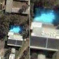
This thumbnail shows the swimming pool at Australia’s top secret Nuclear Facility. On the left is the old ‘zoom level 0’, on the right is the new ‘zoom level 1’ – there is no data available at the new level 0.

I still haven’t found an area in Australia supported by the new zoom levels – the ones in the US I’ve seen are eye-popping. I know there have been super high res areas before, but I’d be interested to hear if others are seeing this the same way I am.

Published
Categorized as geo

the bridge that fell…

westgate bridge
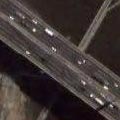
This is the section of
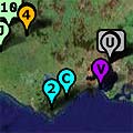
 The Westgate Bridge which fell while under construction on 15th October, 1970, killing 35 workers.

We lived nearby and I was in school (grade 4) at the time, and I remember an announcement coming over the public address calling children whose fathers worked on the bridge to the office. Thought nothing of it at the time, but gives me chills now.

There is a recently renovated memorial park underneath the bridge span – it’s a beautiful spot.
More information about the disaster and the memory here.

Published
Categorized as geo

a rose garden…

Victorian State Rose Garden
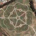
Not just any rose garden, this is the Victorian State Rose Garden at Werribee Park. It even looks like an English Tudor Rose from the air.

The Mansion itself, just to the south west is a fabulous place to visit, and now incorporates a luxury hotel with more formal gardens all around. If you’re into horses, the National Equestrian Center is just to the north of the garden… and if horses aren’t exotic enough, there is always the Victorian Open Range Zoo (map), where you can visit a little African savannah in comfort. In fact, on the photo you can see a few of the tour buses as they visit the Rhinos, Giraffes etc.

The day the photo was taken, there seems to have been some kind of event on in front of the mansion. Nowhere near enough cars for it to have been the Harvest Picnic, which is held here annually, but there’s usually something going on.

Published
Categorized as geo, personal