This map is open to the public

Regulars will know of my weakness for anything to do with maps. Some time ago, this manifested itself in the purchase of a Garmin eTrex Legend Cx. This device is brilliant, perfect for my needs… walking, riding or driving, and after a few hiccups I got it talking to my mac. The only thing I’ve never done is purchased a map.

Garmin charge a pack for their maps, and I’m sure they’re very good – especially for route finding and driving, but for my needs they are overkill in the city and not much good in the bush. So, I was on the lookout for alternatives.

Bandwidth thief!

Last month I got ‘shaped’ – almost two weeks of excruciatingly slow internet – it was horrible. My ISP’s usage page only gives a total, not day by day, but I’ve never gone close before so it was a bit of a surprise. I got a daily report from the ISP and it didn’t tell me much – no pattern I could follow anyway.

October was a new month, I was going to keep a close eye on things. I installed the delightful Net Usage Item plugin for Firefox, but was dismayed as I watched 20% of my bandwidth disappear in 3 days. I could account for about 400Mb – a couple of downloads I’d been putting off until I got my speed back – but 700+Mb was still unaccounted for. I suspected all sorts of things, but none of it really added up, so tonight I sat down with a couple of tools to find out what I could.

The first shock was my network traffic – almost a constant 50 Kilobytes per second! – 180Mb per hour… yikes!

Quick, download Little Snitch and work this out. Obviously something that’s using that much bandwidth will also be using a fair chunk of CPU, so it wasn’t hard to narrow it down… actually, I got it first go… Agent. That’s right – quit the app and the network practically flatlines.

Bandwidth grab 1

Start it up and the network goes ballistic again!

Bandwidth grab 2

So, what’s going on here? I don’t care much, I’ve removed Google Desktop for a start! I’m guessing that disabling the ‘index Gmail’ option in the app would probably have had the same effect, but I’m in no position to mess with my bandwidth this month – I definitely don’t want to be shaped again!

Apple’s forgotten placeholder

lorem ipsum on the apple web siteShouldn’t laugh at the misfortune of others – however small – but Apple’s website is usually so perfect, everything in its place, that when there is a problem you’ve gotta make the most of it! In this case, the hoary old chestnut, the nemesis of graphic designers everywhere – forgotten placeholder text.

On the Australian store’s iPod Nano page, right down the bottom in small, pale text, is that old designer’s friend: Lorem Ipsum.

On the US site, this paragraph is used to run some copyright fluff about movies and iTunes so it’s just a little slip, but all the same, I’ll be interested to see how long it survives in this form.

Published
Categorized as fun, tech

Google finally embeds My Maps

Like every other Google map geek in the world, I’ve been waiting with anticipation for the release of embedded ‘My Maps’. Most unusual for Google to announce a feature before it’s released, usually it’s just a matter of keeping an eye on the blogs or looking for the “New” at the top of the various Google services. This time, however, the news was out more than a week ago, so I’ve been checking daily to see what form the new feature would take. Finally, it’s here with lots of good points and a couple of bad ones.

Published
Categorized as geo, tech

Google is the new axis of evil

The Fairfax created “Brisbane Times” site blares out Terrorists also find Google useful, obviously this google maps thing is a threat to all of us! Presumably the terrorists also found computers rather useful – oh, and the internet! and probably Microsoft’s operating system… yep, we should ban the lot of them.

Alternatively, perhaps we could look at treating the cause of these problems rather than patching over the symptoms… nah! way too hard.

Apple’s new browser ;-)

Another Apple browser?Was doing a bit of ‘drag and drop’ on my mac a while back, when I accidentally ‘dropped’ in the wrong place. The result was a web page that rendered in the software update window.

Not really so surprising given the ubiquity of the webkit in Mac OSX, but to have it render pages so nicely – even with Javascript – was an amusing find.

I don’t know if this opens up a potential security issue, but I could see it as attractive to a nefarious person if they could render their own content into this window in an attempt to trick a user into doing something stupid.

Published
Categorized as fun, tech

So, how did Google do it?

Well, the fact is, they didn’t – entirely. Sure, it appears in Google’s wonderful maps, but the images were captured by a company called Immersive Media, who have developed these innovative products.

Immersive Media's wonder carIt seems that Immersive’s main thrust is moving images – spherical video with embedded geodata – very impressive stuff. In typical Google fashion, however, they’ve released a lo-fi version that really hits the spot. Other blogs have pointed out that the flash player used by google references individual tiles and stitches them together on the fly – very clever stuff.

Immersive say they’ve been taking these photos since 2005. I don’t know what the schedule was, but there is ample evidence of an improvement in the technology over time – the more recent images are substantially higher resolution – compare a New York shot at full zoom with one from San Francisco.

Further evidence of a time lag can be found by comparing the racy little VW with the groovy little camera – which you can occasionally catch a shadow of, with the shadow of a much less streamlined version.

All interesting enough – but really, we know it’s just damn good fun!

newly found – great close up of the van, and a blog post about google van self portraits too!.

Published
Categorized as geo, tech

google maps street view – amazing

When I first used google maps I was utterly speechless at the smooth way they could present the incredible amount of data that the system held. Well, they’ve done it again – in spades!

There are plenty of blog posts talking about it, but the instructions found at googlemapsmania are simple and easy:

head over to Google Maps, center the map on the US and click “Street View”. Click a city with a camera marker and zoom in to have a play.

Once you’re there, click anywhere on a blue outlined street and suspend all disbelief… this is a ‘virtual tour’ on a scale no-one has even dared dream about. For a quick way in, try this view of the Golden Gate Bay bridge (thanks Jeff), which Product Manager, Stephen Chau rates as his favourite.

The big question is HOW? This is a lot of work, in anyone’s language, so how have they done it? Not hard to see that the images are taken in sequence, about 25m apart, and there are reflections that suggest some sort of plastic bubble – probably mounted on top of a car. I would have expected this to be done with a one-shot pano camera, but some images show signs of being stitched (though maybe it’s those reflections again). I’m assuming they are located using geocodes, so that’s probably automated into the exif data… incredible stuff!

Another aspect which should not be overlooked, is that the ‘Link to this page’ link works as you’d hope (better than you’d expect!). It takes you to the map, the location, the view and the zoom level – all in one hit. Business is going to love this!

Just imagine what implications this has if they release some API hooks for the pano viewer!

Published
Categorized as geo, tech

Media copyright breakthrough!

In what must have been a Eureka moment – a company called MRT have hit upon the perfect way of preventing what they call music piracy. Stopping people listening music altogether!! Brilliant!!

If it wasn’t so pathetic, it would be funny, but folks, it’s true (article on Macworld). They are suing Microsoft, Adobe, Real and Apple for, basically, providing players that work.

my maps are google maps

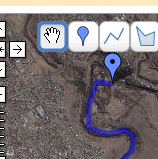
brimbank-gmap1Google’s most revolutionary tool, Google Maps, has just added a new feature – My Maps – which brings ‘mapping’ to the masses.

It is brilliant. You can create maps, draw shapes, make points, add html features such as photos. Sure, there are dozens of tools out there already which allow similar capabilities, but Google, in typical style, have created the basic flexible framework which will see the widespread adoption to make it mainstream. And… the really neat part for me is the ‘KML’ link, which downloads a kml file for Google Earth.

What’s so good about that? You can do all the drawing and mapping in GE, but you can’t manage a web repository of your files – that’s the beauty of ‘My Maps’.

Once I have my KML file I can use GPSBabel to convert it to GPX and upload it to my Garmin eTrex. So, effectively, ‘My Maps’ is now my web based respository of GPS data!

To give it a road test, yesterday I mapped out the route from Maribyrnong park to Brimbank park along the Maribyrnong River. This ride is part of Bicycle Victoria’s ‘Bike path discovery’ program, but you don’t need an excuse to ride it – it is a beautiful track. Anyway, the mapping worked perfectly – I was a happy (and tired) cyclist by the end of the day.

Wishlist: I won’t consider it perfect until I can import kml or gpx I’ve created elsewhere. As it matures, I’d also like to see fuller support for GPX, such as perserving icons etc. but that’s secondary.

Recommendation: get out there and start mapping – I think we’re about to see mapping and mashups go seriously mainstream!

I can even view my flickr stream as GeoRSS in Google maps!

Published
Categorized as geo, tech

geotagging workflow for mac users

It’s not always easy using a Mac. Being in the minority means you don’t have access to many of the tools others take for granted. GPS is a good example. I love my little Garmin eTrex, but Garmin don’t love my mac. They have promised software this year, but details are very sketchy. So, I live hope, but in the meantime, I’ve got things I want to do, like geocoding the 2,000 odd photos I took on a recent holiday to Thailand and Myanmar!

Published
Categorized as geo, tech

a tale of GPS woe…

I’m a little bit obsessed by maps… and gadgets. Oh, alright, computers too! So, naturally, a GPS was one of those things I just had to have. I was lucky enough to have a Garmin eTrex Venture for a six month loan. Nice little unit – some limitations, but as a first taste it was perfect… I was hooked. When the time came to give back the loan unit, I knew I wouldn’t survive without one for long, so I started researching my purchase.

etrex-legendDidn’t take me long to decide on the Garmin eTrex Legend Cx. For a start, I liked the original Garmin, and they were the only company offering Mac support (albeit, at some date in the future). I knew I wouldn’t be satisfied without colour, maps, USB and expandable memory, so the choice was easy.

It is gorgeous. It does everything I could have asked for – and more, but it hasn’t been without it’s problems. It has taken two trips back to the distributor – one for replacement – and a lot of careful testing, but I think I’ve found the problem and just want other Mac/Garmin users to beware.

I have Virtual PC, which allowed me to use Garmin MapSource without a problem, but I also have a number of Mac tools I’ve used with other devices quite happily – my favourite is Load My Tracks. Simple, and it mostly does what I need. My mistake was to use a mac tool while Virtual PC had control of the USB port. I am sure this it the issue, though I’m not about to sacrifice another GPS to test it. Virtual PC ‘captures’ the USB port for its own use, but the Mac still knows it’s there and it seems apps can use it. Result is mixed messages to the GPS, possibly writing data to places it shouldn’t or maybe missing an end of file marker… who knows, but the result seems to be a major software glitch.

Aside from the fact that it happens, which is a bit of a concern, it highlights a major failing with the Garmin that I can’t do a hard reset. Garmin support did at one stage talk me through a couple of ‘reset’ procedures, but they seem to be at a higher level than I needed. Having to send the unit back to base just to have it reset is a bit of a worry.

Anyway, more recently, I’ve kept my MapSource use to a PC and never used LoadMyTracks when Virtual PC was loaded, and things seem to be sweet. I recommend other mac users do the same.

Published
Categorized as tech